facebook
Image showing that the PDF download is in progress... PDF download in progress

Please wait...

Image showing a pink decorative paint splat
Image showing a green decorative paint splat
upload photo button
reviews buttonReviews view map buttonMap
view 3d map button3D Map
directions take me there buttonDirections
Save
PDF
Gpx File

Noosa: Weyba Creek Track

Noosa: Weyba Creek Track
walking icon walking icon black cycling icon cycling icon black
Trail type
difficulty icon
Skill Level
3.3km
Length
direction icon direction icon black
Circuit

A beautiful waterside walk including a mangrove boulevard.

SUITABILITY
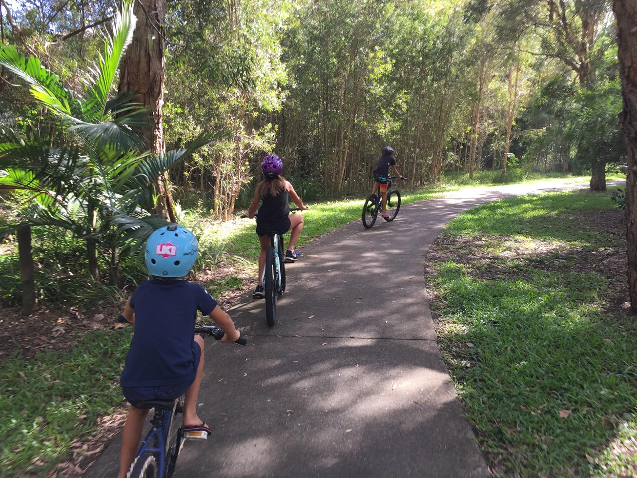
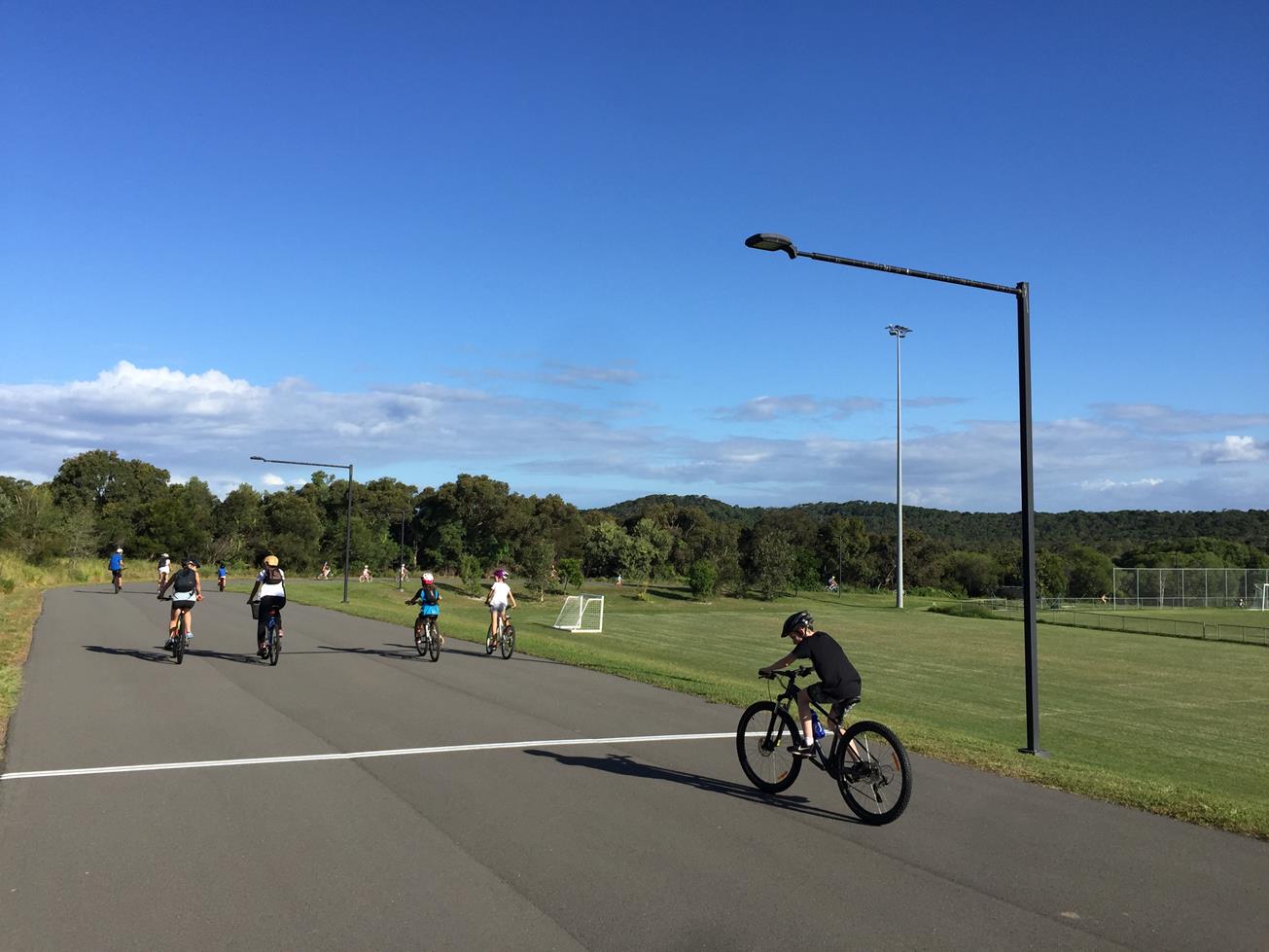
This walk is suitable for families and all ages as well as recreational cyclists.

HIGHLIGHTS
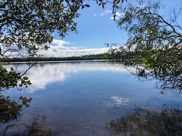
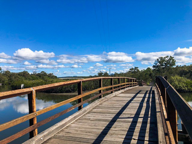
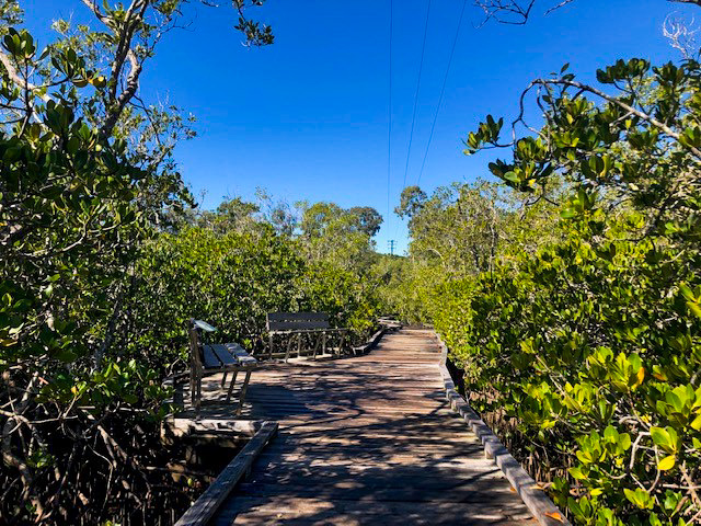
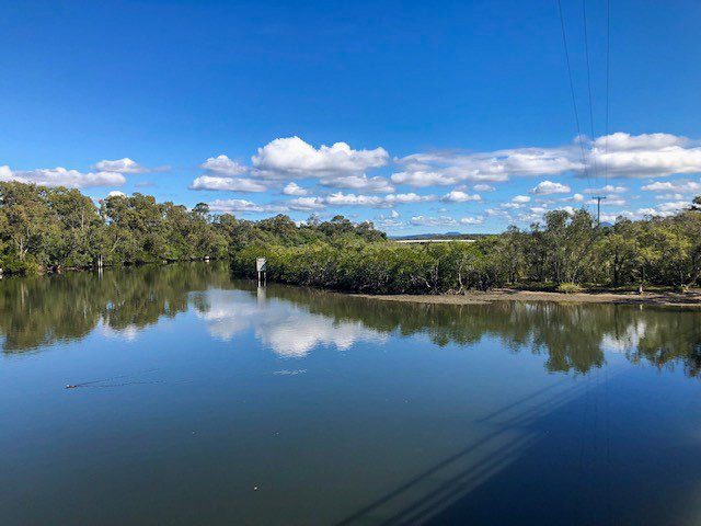
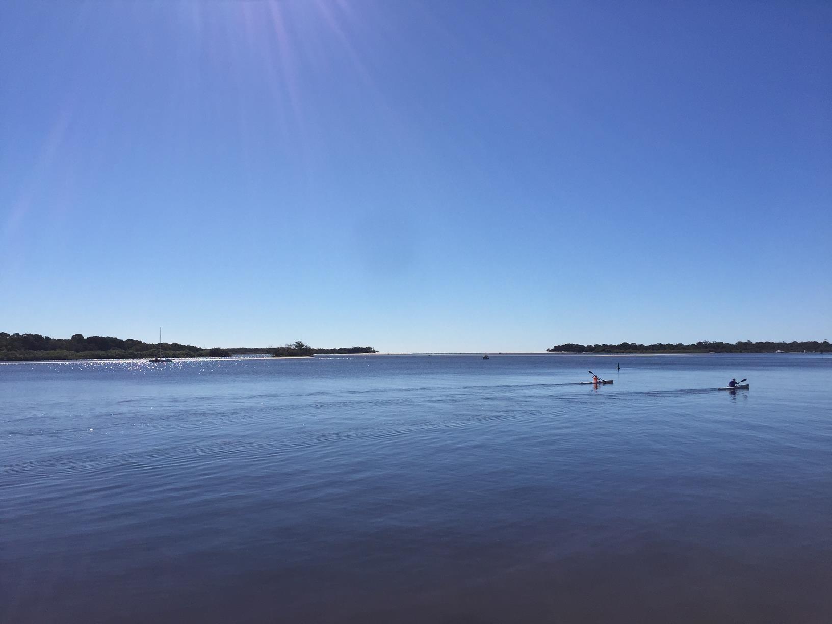
At Nancy Cato Park there is suitable street parking and a huge open green space with covered picnic tables. The track begins along the side of Weyba Creek and follows Weyba Rd past a number of local cafes, specialty shops and an AFL ground. Walkers who time their journey well can stop at the AFL ground for weekly food markets, perfect for lunch supplies, an afternoon treat or just a simple refreshment from one of the many artisanal stalls. Towards the bridge over Weyba Creek lies the Mangrove Boardwalk, a dedicated timber pathway loop exploring the mangrove river bed. This dedicated walk provides walkers with an educational close up view of the fertile mudflats which support such local wildlife as kingfishers, herons, osprey and a range of mud crabs and marine life. The turnaround point is Leslie Park, a small forest conservation area. Walkers can return via the original route or take Weyba Rd for a slightly quicker return.

AFTERWARDS
Stop in at one of the cafes, specialty shops or the market on dedicated days. With such a wonderful selection of hospitality and a number of perfect stopping points, the morning, afternoon or whole day can easily slip by!

HOW TO GET THERE
To Start: Via Eenie Creek Rd turn onto Reef St and continue onto Noosa Pde. Nancy Cato Park is on the right
To End: The end point is the start point.

glossary button
Glossary
  • Icon showing this activity is suitable for wheelchairsSuitable for wheelchairs
  • Icon showing this activity is suitable for walkingSuitable for walking
  • Icon showing this activity is suitable for recreational cyclingSuitable for recreational cycling
  • Icon showing this activity is suitable for mountain bikingSuitable for mountain biking
  • Icon showing this activity is suitable for horse ridingSuitable for horse riding
  • Icon showing this activity is suitable for kayakingSuitable for kayaking
  • Icon showing this activity has drinking water availableDrinking water available
  • Icon showing this activity does not have drinking water availableNo drinking water available
  • Icon showing this activity has a barbeque on siteBarbeque on site
  • Icon showing this activity has a picnic table on sitePicnic table on site
  • Icon showing this activity has toilets on siteToilets on site
  • Icon showing fires are permitted at this activityFires permitted
  • Icon showing fires are prohibited at this activityFires prohibited
  • Icon showing camping is permitted at this activityCamping permitted
  • Icon showing camping is prohibited at this activityCamping prohibited
  • Suitable for walking Suitable for walking black lines Suitable for walking
  • Suitable for recreational cycling Suitable for recreational cycling Suitable for recreational cycling
  • No drinking water available No drinking water available No drinking water available
  • Picnic table on site Picnic table on site Picnic table on site
  • Fires prohibited Fires prohibited Fires prohibited
  • Camping prohibited Camping prohibited Camping prohibited
Write a review

Be the first to review this trail.

hazard icon

IN AN EMERGENCY DIAL '000'.

Always Adventure Safely!

  • Always follow any local signage, it contains key information and conditions can change at any time.
  • Use the trails with consideration for your abilities, be prepared for the adventure ahead:
    • Be aware of the weather conditions, found here: http://www.bom.gov.au/qld/.
    • Always wear appropriate clothing, focus on good footwear.
    • Always bring more water than you think you will need.
    • Be Sun Safe!
    • Always let someone know where you are going that isn’t going with you.
  • Just getting started try this site for good useful information: https://www.trailhiking.com.au/hike-safety/
  • Sunshine Coast Council does it’s best to maintain current information but things can change so always be aware that a trail may not be as listed in this guide, and report and issues via our feedback link.

Noosa Council

For any issues with the trail please call: 07 5329 6500

If you think something on the web site needs to change please let us know via: adventure@sunshinecoast.qld.au

Nearby Trails

Trail Image for Weyba Creek Cycle Loop from Girraween grounds
Easy

Weyba Creek Cycle Loop from Girraween grounds

NOOSA HEADS
walking icon cycling icon
Trail type
difficulty icon
Skill Level

7.3km

Length
direction icon
Circuit
Trail Image for Noosa River: Frying Pan Paddle
Easy

Noosa River: Frying Pan Paddle

NOOSA NORTH SHORE
canoeing icon
Trail type
difficulty icon
Skill Level

2.6km

Length
direction icon
One-way
Trail Image for Road Cycle Route: SCC Big Loop
Difficult

Road Cycle Route: SCC Big Loop

Alexandra Headland
walking icon cycling icon
Trail type
difficulty icon
Skill Level

180.6km

Length
direction icon
Circuit
Trail Image for Girraween Criterium Circuit
Easy

Girraween Criterium Circuit

NOOSA HEADS
walking icon cycling icon
Trail type
difficulty icon
Skill Level

1.1km

Length
direction icon
Circuit
Trail Image for Noosa Spit Recreation Reserve
Easy

Noosa Spit Recreation Reserve

NOOSA HEADS
walking icon cycling icon
Trail type
difficulty icon
Skill Level

2.5km

Length
direction icon
Circuit

Share this trail

This action requires a login.
To continue, click on Login/Signup below.

Photo uploaded successfully, thank you.

Feedback / Suggest an Adventure

If you have any feedback on the site or any of the trails, please drop us a short email.

Have we missed something? Do you have an adventure to suggest? Fill in the suggestion form to let us know about it.